Dholera TP1 Waterfront & Smart Canal Project
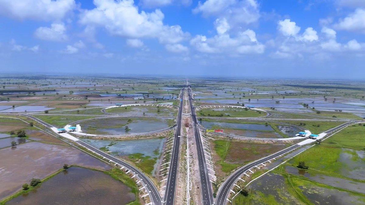
According to newly released project intelligence from the official DholeraPlatform Investment Guide, the central 15-kilometer canal network and stormwater balancing reservoirs inside Town Planning 1 (TP1) are being transformed into a world-class waterfront promenade. This landmark civil engineering and landscaping effort incorporates dedicated cycling tracks, public gardens, civic plazas, and intelligent flood-control channels, marking a decisive step forward in the execution of India’s flagship greenfield smart city.
Dual-Purpose Engineering: Climate Resilience Meets Urban Livability
Learn more in our official Dholera Smart City Infrastructure Overview and TP Schemes Land Maps.
Urban planners and civil engineers within the Dholera Special Investment Region (SIR) have designed the 15-kilometer central canal network to perform two critical functions: robust disaster management and high-quality civic space creation. During monsoon periods, the channel system works in tandem with broad balancing reservoirs to store, regulate, and direct excess runoff, preventing urban flooding across high-density commercial and residential zones.
Beyond hydro-technical protection, the public facing side of the canal features landscaped embankments, multi-tiered pedestrian pathways, and continuous cycling corridors. By combining underground smart infrastructure utilities with aesthetic surface landscaping, Dholera SIR provides a modern urban environment tailored to multinational corporations, technical workers, and residential communities.
TP1 Waterfront as an Economic and Lifestyle Anchor
Town Planning 1 represents the initial activation zone of Dholera SIR, designed to host light engineering units, commercial hubs, high-density residential blocks, and civic amenities. The introduction of the TP1 Waterfront Boulevard adds a major lifestyle element that directly impacts property desirability and institutional interest.
Key structural and landscape components of the project include:
- 15-Kilometer Continuous Canal Network: Fully lined and monitored water channel ensuring year-round aesthetic appeal and controlled flow.
- Integrated Cycling & Pedestrian Corridors: Dedicated, non-motorized transport lanes aimed at promoting low-carbon commuting across TP1.
- Stormwater Balancing Reservoirs: Engineered retention basins that double as public waterfront lakes during dry seasons.
- Civic Plazas & Open Air Amphitheaters: Designed public gathering zones outfitted with smart lighting, public Wi-Fi, and real-time environment sensors.
- Native Flora Landscaping: Micro-climate regulating green belts utilizing indigenous trees to reduce urban heat island effects.
Investors and developers evaluating parcel layout details can review spatial allocations on official Dholera TP maps to understand how waterfront proximity aligns with commercial and residential zoning.
Strategic Implications for Real Estate and Corporate Investors
Infrastructure-driven development remains the primary driver of value within master-planned economic regions. The execution of civic amenities like the TP1 Waterfront Boulevard confirms that Dholera SIR is moving from foundational underground utility construction to visible, top-tier surface infrastructure.
With major connectivity assets such as the Ahmedabad-Dholera Expressway reaching advanced completion and the upcoming Greenfield Dholera International Airport progressing in tandem, civic amenities enhance real estate value proposition based on utility, livability, and long-term capital preservation rather than speculative trading.
Key Investment Takeaways
- Quality of Life Index: World-class urban spaces attract high-skill talent for semiconductor plants, EV manufacturing hubs, and corporate headquarters.
- Risk Mitigation: Comprehensive flood management infrastructure ensures long-term asset protection for industrial complexes and residential towers.
- Zoning Advantage: Properties situated near the central canal belt benefit from enhanced commercial footfall and aesthetic appeal.
Long-Term Outlook
The transformation of Dholera’s 15-kilometer central canal into an active urban promenade demonstrates the maturity of the project's master plan. As industrial anchors begin constructing manufacturing facilities, the presence of high-standard recreational zones ensures Dholera SIR delivers an operational environment comparable to global benchmark cities like Singapore or Shanghai.
Disclaimer: Real estate investments are subject to market conditions and regulatory changes. All project details are based on published planning documentation. Readers must conduct independent financial and legal due diligence before entering into property transactions.
Download High-Res TP Maps & Free Investor Tools
Planning an investment or tracking infrastructure in Dholera SIR? Access our verified GIS master plans, official mobile app, and free advisory.
Dholera TP 1 – TP 6 Maps
High-definition Town Planning master plans, road grid hierarchy, and zoning boundaries for all sectors.
Dholera Android APK
Real-time plot status, interactive GIS layers, push notifications for breaking news, and offline documents.
1-on-1 WhatsApp Advisory
Direct guidance from Naresh Gohel on NA/NOC clear titles, registry verification, and free site visit cab from Ahmedabad.
Investor Resources & Direct Contact
Discussion
Leave a Comment
Planning to Buy Land in Dholera SIR?
Connect directly with founder Naresh Gohel for verified TP1 & TP2 plot availability, Collector NA title search, and government circle rate guidance.