Dholera Smart Riverfront 2026: Central Canal & TP1 Land Surge
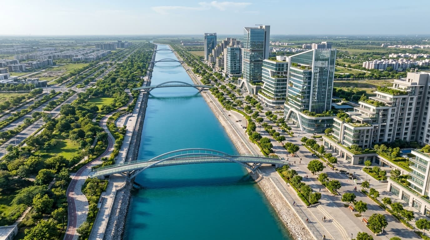
Urban livability and waterfront landscape architecture reached a landmark turning point today as water-filling trials commenced along the 6.5-kilometer artificial central canal of Dholera Smart Riverfront 2026. Meandering through Town Planning Scheme 1 (TP1) and the central Activation Zone, this world-class waterfront corridor integrates flood management, civic recreation, landscaped promenades, and commercial high-rises, triggering unprecedented investor interest in adjacent residential and mixed-use land parcels across Dholera Special Investment Region (SIR).
Executive Riverfront Briefing: Key Project Benchmarks
Official engineering specifications confirmed by Dholera Industrial City Development Limited (DICDL) and Gujarat Infrastructure Development Board (GIDB):
- Canal Dimensions & Flow: 6.5-kilometer central channel with a width varying between 70 to 120 meters, maintaining a perennial 3.5-meter navigable water depth.
- Dual-Purpose Hydrology: Advanced stormwater drainage balancing reservoir equipped with automated tidal gates to prevent regional flooding during peak monsoons.
- Pedestrian Promenade & Green Belt: 15-meter wide stone-paved walkways, shaded cycle tracks, and over 45,000 native microclimate shade trees along both banks.
- High-FSI Waterfront Zoning: Premium Town Planning 1 waterfront commercial zones permitted up to 5.0 Floor Space Index (FSI) for iconic hospitality and corporate towers.
Dholera Smart Riverfront 2026: Engineering Gujarat’s Largest Artificial Waterfront
Inspired by the global success of the Sabarmati Riverfront in Ahmedabad and the Marina Bay canal system in Singapore, Dholera Smart Riverfront 2026 combines heavy civil engineering with cutting-edge environmental conservation. Designed by Halcrow and AECOM under the DMIC master plan, the central canal serves as the primary freshwater circulation artery for the entire special investment region.
The concrete-lined embankment incorporates subterranean geofabric liners and geotextile filters that eliminate soil erosion while recharging groundwater aquifers. SCADA-monitored automated sluice gates regulate continuous water circulation, ensuring pristine water clarity and supporting recreational boating, water taxis, and open-air floating amphitheaters that will form the cultural heart of the smart city.
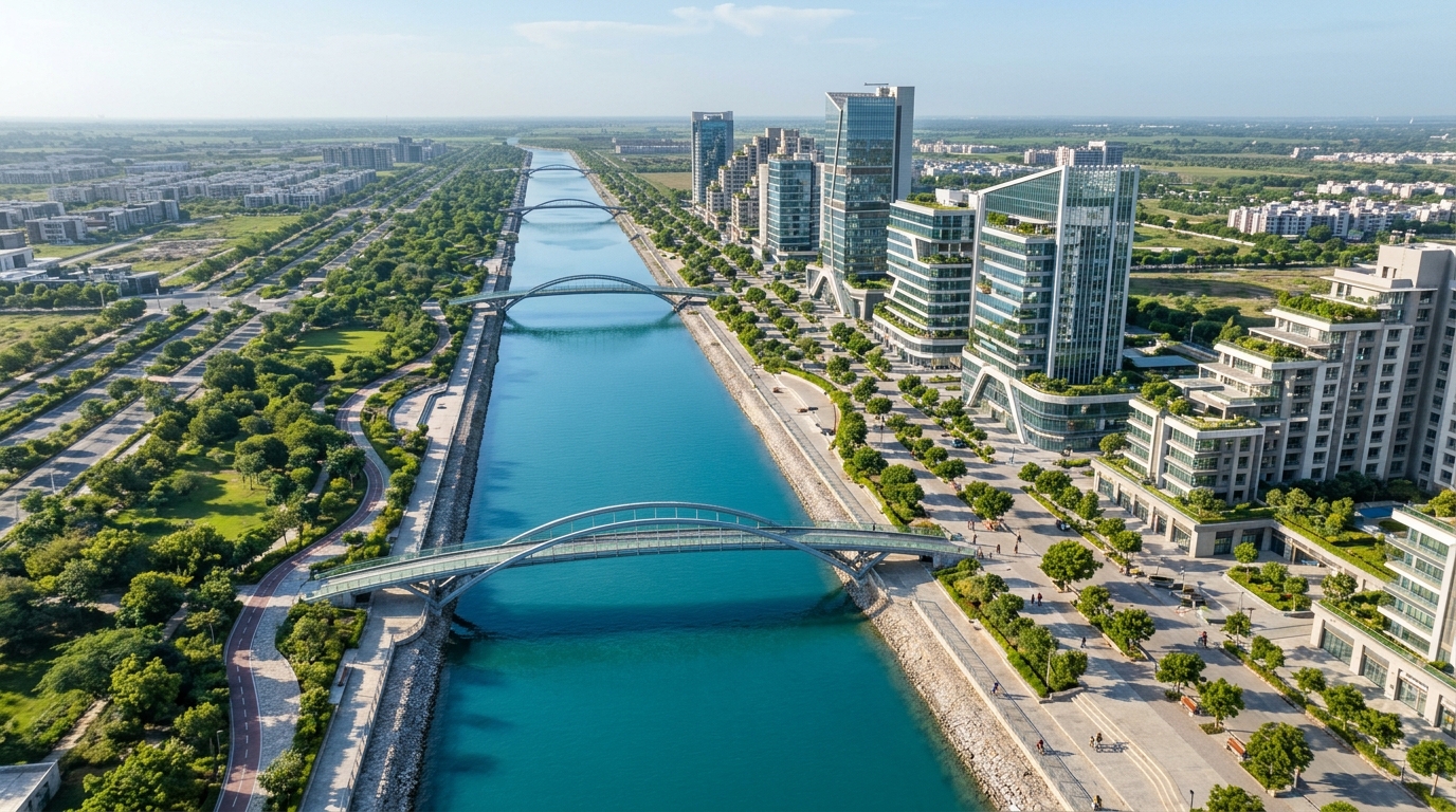
Figure 1: High-altitude aerial view of Dholera Smart Riverfront 2026 central canal, arch pedestrian bridges, and commercial boulevard towers.
Microclimate Moderation & Sustainable Smart City Ecology
Beyond aesthetic and leisure appeal, Dholera Smart Riverfront 2026 functions as a critical natural cooling system for the urban landscape. By harnessing natural wind corridors flowing inland from the Gulf of Khambhat across the water surface, the canal lowers ambient summer temperatures in surrounding TP1 residential sectors by 2.5 to 3.5 degrees Celsius, drastically reducing building air-conditioning energy demand.
Furthermore, tertiary-treated water from Dholera’s 20 MLD Sewage Treatment Plant (STP) undergoes secondary bio-filtration through reed beds and floating wetlands before entering the canal basin. This closed-loop urban water recycling strategy guarantees that no potable freshwater is squandered on civic landscaping, earning Dholera SIR prestigious IGBC Green Cities Platinum certification.
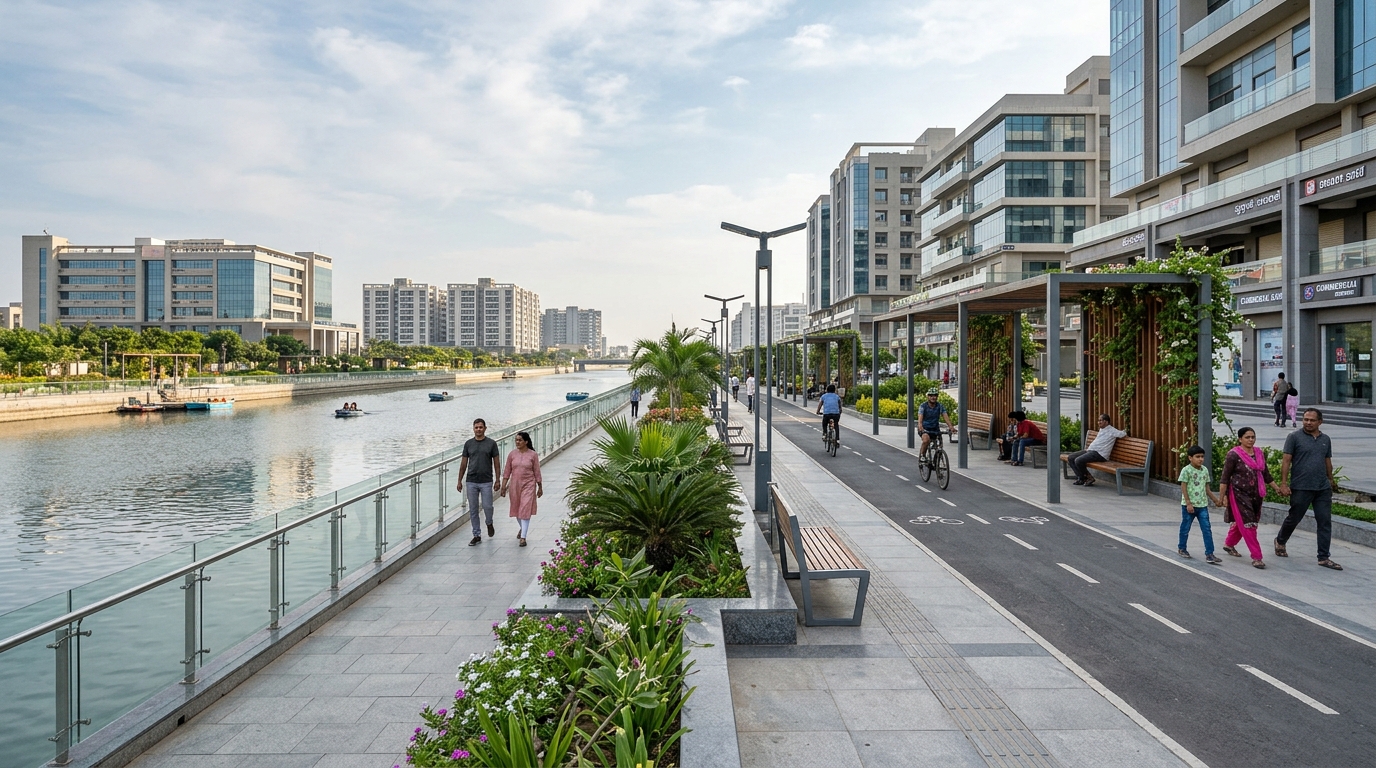
Figure 2: Ground-level architectural perspective of the TP1 waterfront promenade featuring shaded pergolas, cycling lanes, and landscaped plazas.
Multi-Modal Connectivity: Bridges, Water Taxis & Transit Links
The waterfront district is engineered for seamless accessibility across all modes of transportation:
- Pedestrian Arch Bridges: Six architecturally distinct cable-stayed and arch bridges provide continuous walking and cycling connections between eastern and western TP1 neighborhoods.
- Electric Water Taxi Service: Solar-powered catamaran water taxis operate between the ABCD central administration complex, the financial district, and residential marinas.
- Integrated Metro Station Spur: Elevated stations of the Ahmedabad-Dholera RRTS link directly to riverfront arrival plazas via weather-protected skywalks.
- Smart Boulevard Interchanges: 55-meter and 70-meter arterial boulevards flank both embankments, featuring underground utility ducts and automated EV charging terminals.
This multi-layered mobility framework ensures that residents and corporate visitors can traverse the central waterfront zone without encountering vehicular congestion, fostering a vibrant pedestrian-first urban lifestyle comparable to leading European riverfront cities.
Impact on Real Estate Valuations in TP1 Waterfront Corridors
The filling of the canal and unveiling of permanent promenade landscaping has created an intense surge in land transactions. Plots fronting Dholera Smart Riverfront 2026 or situated within 500 meters of the water canal command substantial pricing premiums due to their irreplaceable scenic views, superior FSI allocations, and unmatched commercial footfall potential.
| Corridor / Micro-Market | Zoning Designation & FSI | 2024 Base Rate | Q4 2026 Current Rate | Projected 2028 Value |
|---|---|---|---|---|
| TP1 Riverfront Boulevard Frontage | Commercial Mixed-Use & Hospitality (FSI 5.0) | ₹4,500 – ₹6,000 / sq.yd | ₹11,000 – ₹16,500 / sq.yd | ₹28,000 – ₹38,000 / sq.yd |
| TP1 Central Canal Residential Belt | Luxury Gated Villas & Condominiums (FSI 2.2) | ₹3,600 – ₹4,800 / sq.yd | ₹8,800 – ₹13,500 / sq.yd | ₹22,000 – ₹29,000 / sq.yd |
| TP2 Canal Siphon Commercial Buffer | Retail Plazas & Corporate Office Parks | ₹3,400 – ₹4,500 / sq.yd | ₹8,200 – ₹12,400 / sq.yd | ₹20,000 – ₹27,000 / sq.yd |
Compare TP1 vs TP2 Plug-and-Play Plot Rates
Request the verified 2026 per-sq-yard valuation index, duct connectivity verification, and approved NA/NOC inventory delivered directly to you.
Strategic Investment Insights for Waterfront Plot Buyers
For high-net-worth investors and commercial developers seeking exposure to Dholera Smart Riverfront 2026, acquiring parcels within Town Planning Scheme 1 with direct access to canal feeder roads delivers optimal long-term capitalization. Investors should verify final draft TP layout demarcations, ensuring clear titles and immediate proximity to planned pedestrian bridges.
Explore Verified High-Growth Opportunities in Dholera SIR
For statutory town planning maps and detailed zoning guidelines, visit the Dholera Industrial City Development Limited (DICDL) Authority or explore state tourism infrastructure initiatives at the Gujarat Tourism Development Corporation Official Portal.
Frequently Asked Questions (FAQs)
What is the total length of Dholera Smart Riverfront 2026?
The central canal riverfront stretches for 6.5 kilometers through Town Planning 1 and the Activation Area, with canal widths varying from 70 to 120 meters and a perennial depth of 3.5 meters.
How does the central canal prevent monsoon flooding in Dholera?
The canal operates as an intelligent stormwater retention basin controlled by SCADA-automated tidal sluice gates, releasing excess runoff safely into the Gulf of Khambhat without flooding city streets.
What commercial activities are permitted along the riverfront?
The zoning permits high-density mixed-use developments with up to 5.0 FSI, including five-star hotels, corporate headquarters, luxury waterfront retail promenades, open-air cafes, and marina berths.
Will electric water taxis operate on the Dholera canal?
Yes, the master plan includes solar-electric water catamarans linking the ABCD administrative building, business parks, and residential sectors along dedicated ferry piers.
Can retail investors buy residential plots near the riverfront?
Yes, government-sanctioned NA residential and mixed-use plots are available within walking distance of the TP1 waterfront promenade, offering clear legal titles and immediate registration.
Download High-Res TP Maps & Free Investor Tools
Planning an investment or tracking infrastructure in Dholera SIR? Access our verified GIS master plans, official mobile app, and free advisory.
Dholera TP 1 – TP 6 Maps
High-definition Town Planning master plans, road grid hierarchy, and zoning boundaries for all sectors.
Dholera Android APK
Real-time plot status, interactive GIS layers, push notifications for breaking news, and offline documents.
1-on-1 WhatsApp Advisory
Direct guidance from Naresh Gohel on NA/NOC clear titles, registry verification, and free site visit cab from Ahmedabad.