Dholera Metro Rail 2026: Ahmedabad RRTS Stations & TP1 Surge
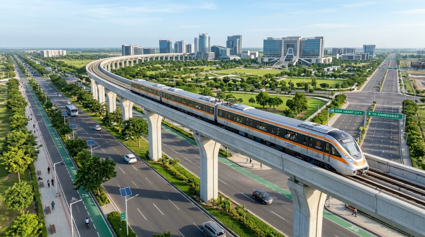
Rapid urban transit in Gujarat entered a transformative phase today as high-speed test runs commenced along the dedicated viaduct of Dholera Metro Rail 2026. Connecting Ahmedabad's central transit hubs directly to the Dholera Special Investment Region (SIR), this premier Regional Rapid Transit System (RRTS) slashes travel time between the twin economic poles to under 45 minutes, unlocking massive commercial momentum and driving residential land appreciation across Town Planning Scheme 1 (TP1) and the Activation Zone.
Executive Transit Briefing: Key Project Benchmarks
Technical parameters verified by Gujarat Metro Rail Corporation (GMRC) and the National Industrial Corridor Development Corporation (NICDC):
- Transit Velocity & Timing: Aerodynamic standard-gauge trainsets engineered for operating speeds of 160 km/h, reducing transit duration to 42 minutes.
- Dedicated Greenfield Alignment: 100-kilometer dedicated central corridor running parallel to the Ahmedabad-Dholera Expressway (NH-751).
- Direct Aerotropolis Interchange: Elevated terminal link seamlessly integrating Dholera International Airport with the central TP1 business district.
- Transit-Oriented Development (TOD): 1.5-kilometer high-density development buffer zones surrounding each designated metro passenger station.
Dholera Metro Rail 2026: Route Alignment & Ahmedabad Junctions
The execution of the high-speed regional rail link marks a pivotal milestone under the Delhi-Mumbai Industrial Corridor (DMIC) master plan. Designed to bridge the 100-kilometer stretch between Ahmedabad and Gujarat’s first greenfield smart city, Dholera Metro Rail 2026 establishes uninterrupted mass passenger transit for engineers, corporate executives, and international technology specialists moving daily into the special investment region.
Starting from the multimodal transit interchange at Gandhinagar and Ahmedabad APMC terminal, the elevated route follows the median reserve of NH-751 before entering Dholera SIR through Town Planning 1. The line features automated Communications-Based Train Control (CBTC) signaling, full platform screen doors (PSDs), and solar-powered regenerative braking systems, setting new environmental benchmarks for Indian public transportation.
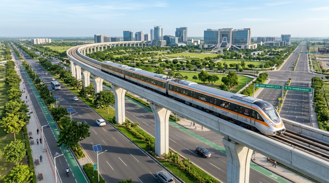
Figure 1: High-altitude aerial view of Dholera Metro Rail 2026 elevated viaduct, aerodynamic rapid train, and 70-meter wide landscaped boulevard.
Accelerating Tech Mobility for Tata Semiconductor Hub & Smart City
The rapid mobility offered by Dholera Metro Rail 2026 directly empowers the burgeoning semiconductor ecosystem anchored by Tata Electronics and PSMC Taiwan in Town Planning Scheme 2. Cleanroom operations demand around-the-clock availability of specialized process engineers and materials scientists who prefer residing within established educational and residential enclaves in Ahmedabad while commuting effortlessly to Dholera.
Furthermore, global ancillary electronics suppliers, precision robotics manufacturers, and data center operators situated within the 22.5-square-kilometer Activation Zone benefit from reliable, congestion-free corporate transit. By eliminating interstate highway driving delays, international business delegations visiting the Administrative and Business Centre for Dholera (ABCD Building) enjoy effortless transfers directly from Ahmedabad International Airport.
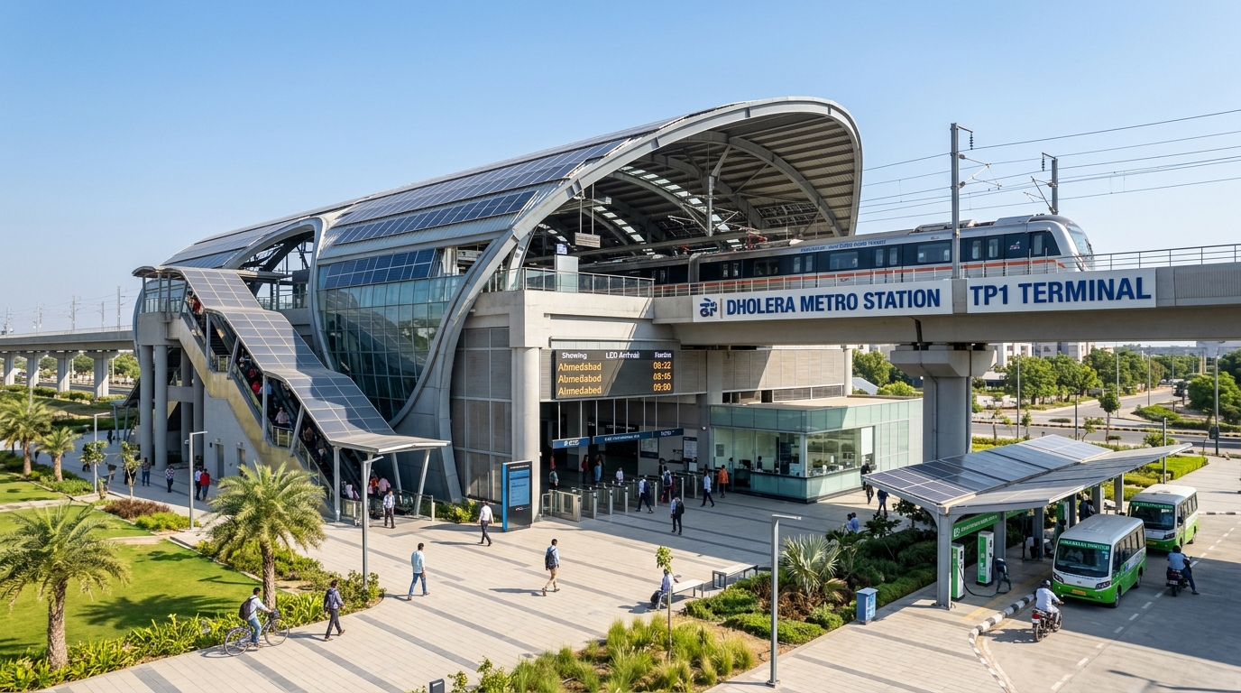
Figure 2: Ground-level architectural perspective of the modern TP1 terminal station featuring solar glass canopies, EV shuttle bays, and passenger concourse.
Multi-Modal Transit Synchronization: Airport, Expressway & Metro
What sets Dholera Metro Rail 2026 apart is its meticulous integration with Gujarat’s comprehensive multi-modal transport grid:
- Dholera International Airport Passenger Spur: Dedicated terminal loop providing 10-minute check-in transit between international flight gates and the city core.
- NH-751 Expressway Co-Location: Shared right-of-way optimizing land acquisition and preserving surrounding agricultural and green buffer reservations.
- Automated Last-Mile EV Feeder Shuttles: Solar-charged feeder buses connecting residential sectors in TP1 directly to primary elevated transit platforms.
- Subterranean Smart Duct Synchronization: High-voltage traction power feeds buried securely within underground utility corridors, preventing above-ground wire clutter.
With synchronized ticketing through the National Common Mobility Card (NCMC), commuters can transition effortlessly between Ahmedabad city buses, Gandhinagar metro lines, and Dholera regional transit using a single digital tap. This smooth interoperability guarantees rapid passenger adoption and positions the corridor as a national model for sustainable regional connectivity.
TP1 & TP2 Real Estate Valuation Surge Along the Metro Corridor
The progression of physical track construction has triggered immediate capital appreciation for plots located within the designated Transit-Oriented Development (TOD) influence zones. Town Planning Scheme 1, serving as the residential and commercial anchor for Dholera Metro Rail 2026, has witnessed intensified acquisition interest from corporate developers and individual retail investors seeking premium NA-cleared plots.
| Metro Station Zone | Permitted Land Use / FSI | 2024 Base Rate | Q4 2026 Current Rate | Projected 2028 Value |
|---|---|---|---|---|
| TP1 Central Station TOD Hub | Commercial & High-Density Mixed (FSI 4.0) | ₹4,200 – ₹5,500 / sq.yd | ₹9,500 – ₹14,800 / sq.yd | ₹24,000 – ₹32,000 / sq.yd |
| TP1 Residential Sector Belt | Gated Villa & Residential Township (FSI 1.8) | ₹3,400 – ₹4,600 / sq.yd | ₹8,000 – ₹12,200 / sq.yd | ₹19,500 – ₹26,000 / sq.yd |
| TP2 Semiconductor Fab Station | High-Tech Industrial & Ancillary Offices | ₹3,800 – ₹5,000 / sq.yd | ₹8,900 – ₹13,600 / sq.yd | ₹22,000 – ₹29,500 / sq.yd |
Compare TP1 vs TP2 Plug-and-Play Plot Rates
Request the verified 2026 per-sq-yard valuation index, duct connectivity verification, and approved NA/NOC inventory delivered directly to you.
Strategic Guidelines for Land Investors Near Metro Stations
Investors targeting long-term wealth creation around Dholera Metro Rail 2026 corridors should prioritize plots situated within 500 to 1,500 meters of planned station interchanges. These micro-locations capture the highest footfall demand, command superior rental yields for corporate guest houses, and benefit from relaxed government zoning norms facilitating elevated floor space index (FSI) allocations.
Explore Verified High-Growth Opportunities in Dholera SIR
For official transit maps and technical execution blueprints, consult the Gujarat Metro Rail Corporation (GMRC) Official Portal or inspect master town planning guidelines at the Dholera Industrial City Development Limited (DICDL) Authority.
Frequently Asked Questions (FAQs)
What is the planned travel time for Dholera Metro Rail 2026?
The high-speed regional rapid transit system connects Ahmedabad to Dholera SIR in approximately 42 to 45 minutes, operating at maximum design speeds of 160 km/h along the dedicated expressway corridor.
How many stations are planned along the Ahmedabad Dholera Metro route?
The initial phase features key regional stations connecting Ahmedabad APMC, Dholera International Airport, Town Planning 1 (TP1) Central Business District, and the Town Planning 2 (TP2) Semiconductor SEZ.
How does the metro line benefit real estate in TP1?
Stations situated in TP1 unlock high-density Transit-Oriented Development (TOD) zones, allowing higher floor space index (FSI) and generating intense demand for commercial offices and executive housing.
Will Dholera Metro connect directly to the international airport?
Yes, the metro corridor includes an elevated spur with a dedicated station right inside the Dholera International Airport passenger terminal complex for seamless air-rail transfers.
Can investors purchase title-cleared residential plots near metro stations?
Yes, verified government-approved NA residential and commercial plots are available across Town Planning 1 within walking distance of designated metro transit hubs with complete legal documentation.
Download High-Res TP Maps & Free Investor Tools
Planning an investment or tracking infrastructure in Dholera SIR? Access our verified GIS master plans, official mobile app, and free advisory.
Dholera TP 1 – TP 6 Maps
High-definition Town Planning master plans, road grid hierarchy, and zoning boundaries for all sectors.
Dholera Android APK
Real-time plot status, interactive GIS layers, push notifications for breaking news, and offline documents.
1-on-1 WhatsApp Advisory
Direct guidance from Naresh Gohel on NA/NOC clear titles, registry verification, and free site visit cab from Ahmedabad.